Drone LiDAR Survey for Solar Farm Design in the UK
 Jason H
Published on: 22/07/2026
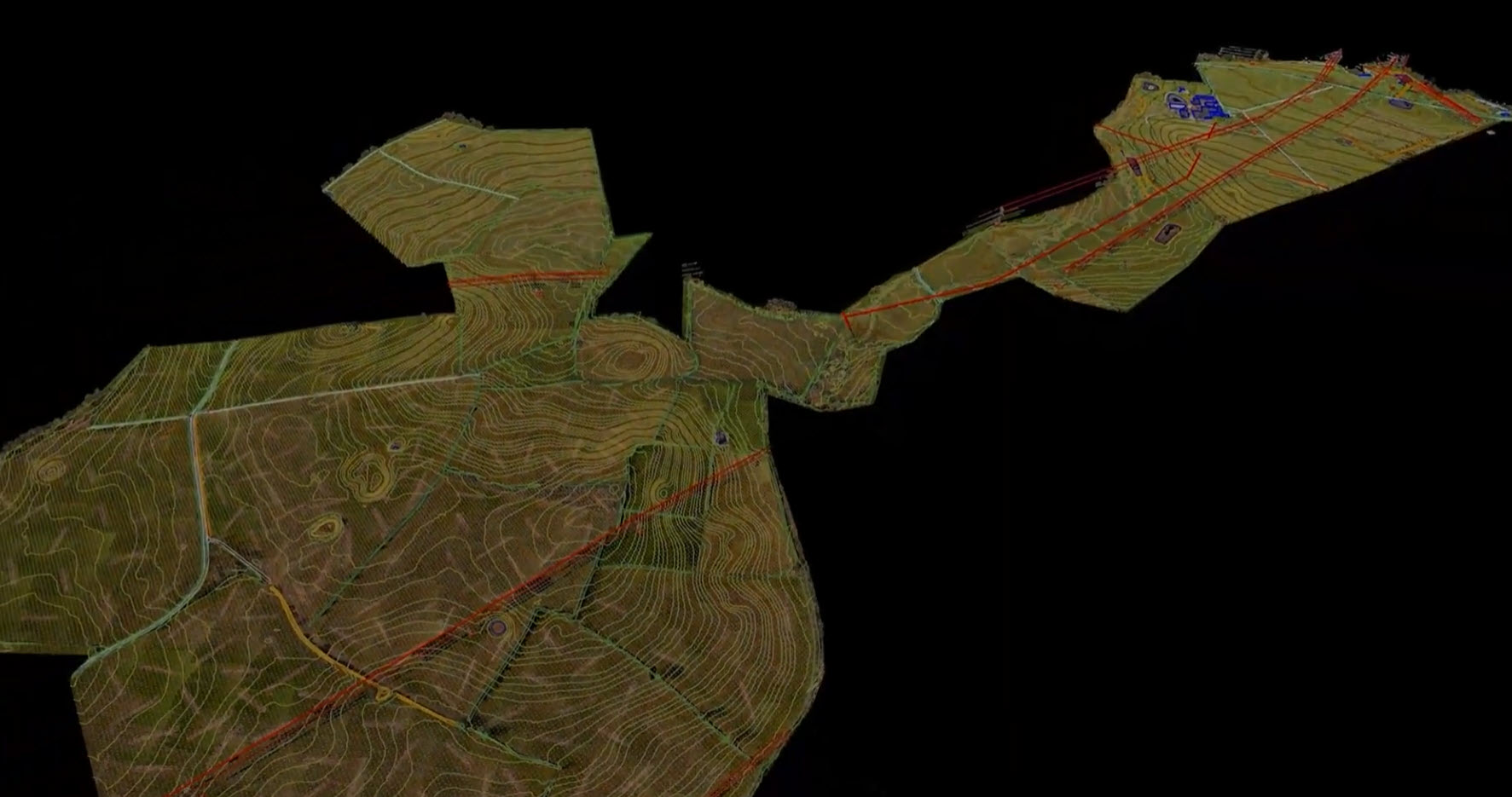
See how a drone LiDAR survey mapped 100 hectares of UK farmland for solar farm design, capturing terrain, vegetation and HV pylon data in a single day.
Case StudyLiDAR