


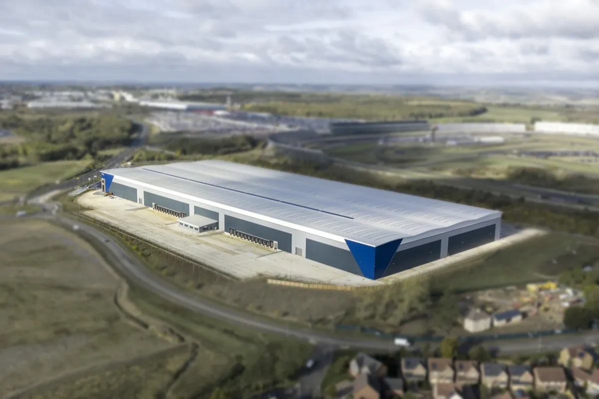
Inspecting a 60,000 m² Roof Without the Scaffolding: Drone Surveys for Facilities Teams
Facilities and estates teams responsible for more than one building face a recurring problem: knowing the condition of every roof, without the time and cost of arranging physical access at each site. Scaffolding and mobile elevated working platforms (MEWPs) both do the job, but each comes with its own lead time, hire cost and access requirements, which adds up quickly once you're managing a portfolio rather than a single building. Drone surveys offer a faster route to the same information - without anyone needing to go onto the roof at all.
Why Roof Access Is Expensive Across a Portfolio
Arranging physical access to a single roof is manageable. Arranging it repeatedly, across a spread of sites with different layouts, heights and access constraints, is where costs and delays compound. Scaffolding typically needs several days for erection and dismantling alone, longer where permits are involved; MEWPs are quicker to deploy but still depend on suitable hardstanding and vehicle access being available at every site. None of that time is spent actually assessing the roof - it's all overhead before the inspection can even begin.
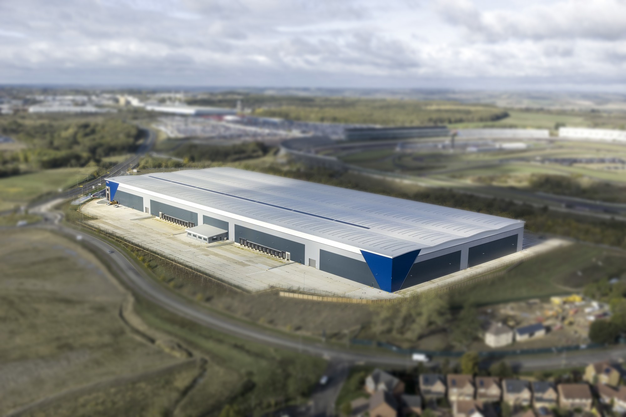
The bigger the building, the bigger the head ache with access equipment.
How Drone Surveys Replace Scaffolding and MEWPs for Routine Inspection
A drone survey captures the same roof areas, from multiple angles, without anyone standing on them. That matters under the Work at Height Regulations 2005, which direct employers and anyone controlling the work - including the facilities manager who appoints the contractor - to avoid work at height altogether where it's reasonably practicable. An aerial survey is one of the clearest ways to do that for a routine condition check, reserving physical access for situations where a defect genuinely needs a closer look or hands-on repair.
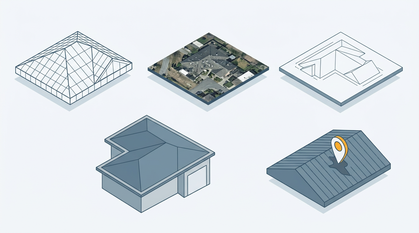
The output is a 3D model and orthomosaic of the building, a CAD roof plan, and high-resolution imagery with each defect located precisely on the model rather than described by hand in a written report. For a facilities team managing several sites, having that output in the same consistent format for every building makes it far easier to compare condition across the portfolio, not just within one roof.
From a Single Survey to a Planned Preventative Maintenance (PPM) Programme
A one-off survey establishes a baseline. The real value comes from repeating it. RICS' guidance on Planned Preventative Maintenance treats a Schedule of Defects as the factual record and a PPM schedule as the plan built on top of it, grading each defect by priority - urgent, immediate, short, medium or long term - so spend gets directed at what matters most this year rather than spread evenly across a long list. Repeating the same condition inspection at each site on a set interval turns that baseline into a maintenance history: new defects are flagged, existing ones tracked to resolution, and budget conversations are backed by evidence rather than a general sense that "the roof needs looking at".
That evidence base also has a second use worth knowing about. A dated, independent record of condition is useful if a dispute ever arises over whether a defect was pre-existing or new - whether that's a contractor handover, a lease event, or an insurance claim after storm damage.

Scale Changes the Approach: A 60,000 m² Logistics Hub
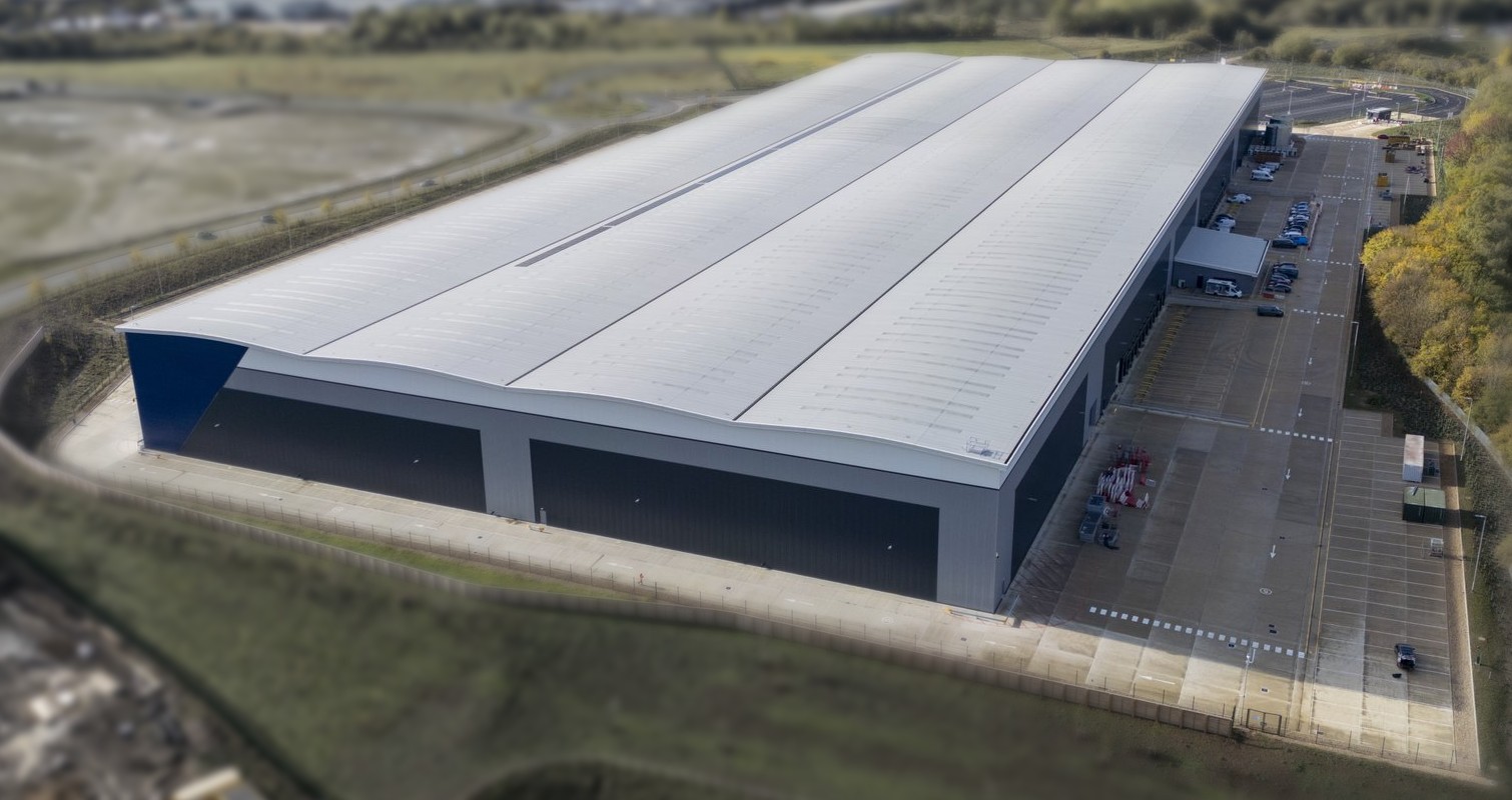
Size exposes the weak points of a routine drone survey. We recently surveyed a 60,000 m² logistics hub, roughly 150 m long and 22 m high, with limited clear space around it. The hard part on a building this size is capturing the detail needed to assess roof sheet fixings. An entry-level drone with a 20 MP camera struggles here. The operator often cannot get far enough back from the walls to keep the aircraft in visual line of sight, and the drone will lose its control link as it nears the centre of the roof. Even a completed flight can leave thousands of images, which are slow to review and hard to compare.
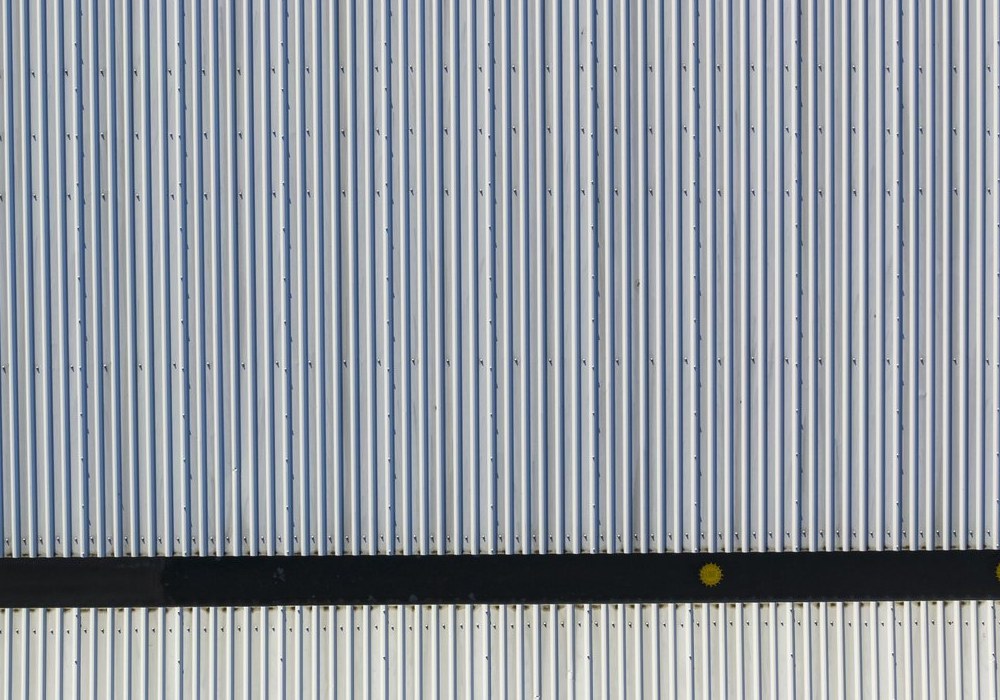
The approach that worked used a DJI Matrice 350 with a Zenmuse P1 camera and a 50 mm lens. The P1 with that lens lets the aircraft work at a safe operating distance, keeps visual line of sight, and covers more roof per pass, so there are far fewer images to process. One site of this size was captured in 2 to 3 hours. The output included detailed inspection imagery, plus a 3D model and point cloud for CAD extraction.
Conclusion
For a facilities management team covering more than one site, the case for drone-based roof inspection isn't really about a single survey - it's about replacing an expensive, slow access process with one that's fast, safe, and repeatable across an entire portfolio. If you'd like to talk through what a recurring inspection programme could look like for your estate, get in touch.
Ready to Get Started?
If you're planning recurring roof or building condition surveys across a multi-site portfolio, get in touch - we'll help you plan an inspection programme that fits your estate.
We’ll help you understand your options and make sure you get the best value for your budget.
Have questions about drone surveys or any of our services? Let us know what you need - we’re always happy to help.
Remember: A drone survey is an investment in accurate, actionable data that can save you time, money, and headaches down the line. Let’s make your project a success!
If you’re ready to experience the benefits of a drone survey, we’d love to help. Contact us by phone 01772 846229 or post your enquiry via our website.
Let’s discuss how we help you leverage drone technology in your next project.