


Drone Survey and 3D CAD for Commercial Rooftop Solar Projects
Designing a solar installation for a large industrial or commercial roof starts with a question that's harder to answer than it sounds: what is actually up there?
Roof profile, sheet type, and obstructions like vents, skylights and plant all affect panel layout, and most of that detail is invisible from satellite imagery or an old set of building plans.
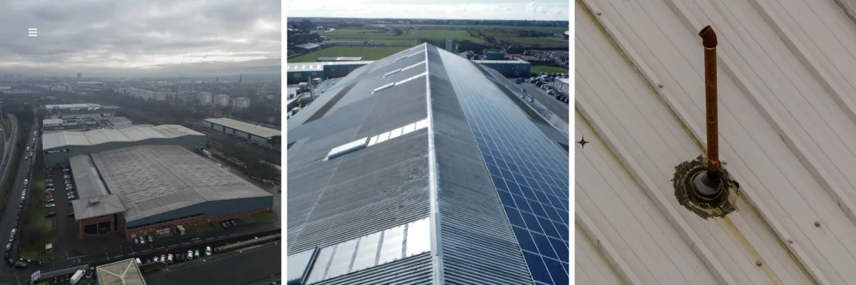
DroneWorks provide accurate, design-ready roof data for a large commercial building being assessed for rooftop solar - without the cost and disruption of scaffolding or access equipment.
The problem with designing solar from a desk
A desktop feasibility study built on satellite imagery or outdated drawings can get a project started, but it rarely holds up once a design has to be finalised.
Roof obstructions, sheet profile and pitch are hard to judge accurately from above, and any gaps in that picture tend to surface at the worst possible time - during detailed design, or worse, during installation.
Physical access surveys solve the accuracy problem but introduce a new one: scaffolding, cherry pickers or rope access all carry a time and cost penalty that's difficult to justify at feasibility stage, before a project has even been confirmed, and even then rarely give full coverage of a large roof.
How the drone survey works
DroneWorks surveyed the building using a DJI M350 fitted with a 45-megapixel P1 sensor, capturing high-resolution, overlapping imagery of the entire roof in a single site visit.
Ground control points were used to tie the survey into an accurate coordinate system, and the resulting imagery was processed into an orthophoto-backed 3D model of the building.
From that model, a CAD roof plan was extracted showing sheet profile, ridge and valley lines, and every obstruction visible on the roof - vents, skylights, plant and other protrusions that would affect panel layout and installation. Read more about our CAD roof plan service.

What installers and developers receive
The survey produces a set of deliverables aimed squarely at the design and quotation stage.
CAD drawings detail everything visible that would affect the solar installation, backed by an orthophoto layer so the linework is tied to real imagery rather than hand-measured notes.
A 3D model of the building lets a design or installation team explore the roof before ever setting foot on site, and high-resolution imagery supports an optional chartered surveyor's condition report, hosted in the same interactive platform as the survey data - see our CAD roof plans page for more detail.
Everything is delivered from one site visit, typically within seven days.


Deliverables built for remote collaboration
Because every deliverable is hosted on a cloud-based platform accessible from any internet-enabled device, a design team, structural engineer and site manager can all review the same annotated 3D model and reach the same conclusions about a roof - without needing to visit together, or in some cases without needing to visit at all.
Some clients even share the model with their contractors so everyone is working from the same information, reducing risk, increasing collaboration and ultimately more accurate pricing.
On large or difficult-to-access buildings, that alone can remove several return trips from a project. Where a structural condition check is also needed, it can draw on the same site visit and the same platform, rather than requiring a second survey.
Getting the data into existing design workflows
Drone-derived 3D models can also feed into PV design software such as PVsyst or PVsol, though those tools generally handle high-detail models poorly and need a reduced-detail export to import cleanly.
DroneWorks works with installers to prepare the right level of detail for their design software, or measurements can be taken directly from the full-resolution model on demand - useful when a design question comes up after the initial export.

Conclusion
For installers and PPA developers assessing large or difficult-to-access commercial roofs, a single drone survey visit can remove much of the guesswork - and much of the access cost - from early-stage solar design.
If you have a commercial or industrial roof you're assessing for solar, get in touch to discuss the survey approach that fits your site.
Ready to Get Started?
If you're planning a commercial rooftop solar installation and need accurate roof data before you design or quote, get in touch.
We’ll help you understand your options and make sure you get the best value for your budget.
Have questions about drone surveys or any of our services? Let us know what you need - we’re always happy to help.
Remember: A drone survey is an investment in accurate, actionable data that can save you time, money, and headaches down the line. Let’s make your project a success!
If you’re ready to experience the benefits of a drone survey, we’d love to help. Contact us by phone 01772 846229 or post your enquiry via our website.
Let’s discuss how we help you leverage drone technology in your next project.