


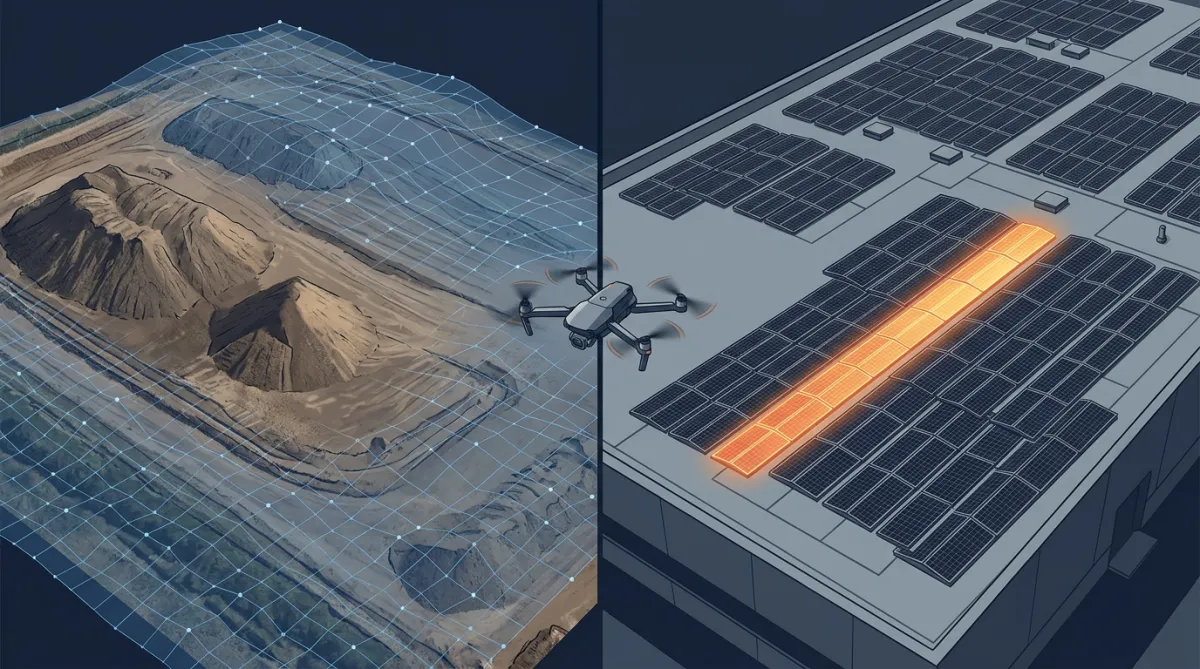
Case Study: Earthworks Monitoring in Teesside and Thermal Solar Inspection in Morecambe
Aerial surveying earns its keep when it answers a question the project team actually has. On two recent jobs, an earthworks site in Teesside and a commercial rooftop solar array in Morecambe, the questions were "how much material has moved?" and "why is this array underperforming?". Here is how we answered both from the air, and what the wider industry evidence says about the accuracy you can expect. Both sites would have taken days via traditional methods.
Tracking earthworks and stockpiles in Teesside
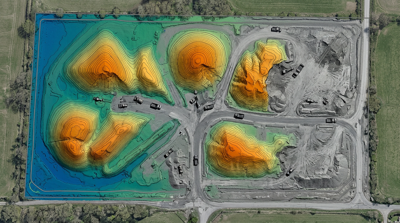
Our brief in Teesside is ongoing: regular monitoring of earthworks progress and stockpile volumes on a live site. Each visit follows the same flight plan, capturing overlapping imagery that is processed into a georeferenced surface model tied to ground control.
The accuracy question matters here, because volumes feed into valuations and reconciliation. The industry evidence is consistent: photogrammetry with RTK/PPK positioning and proper ground control typically achieves volumetric accuracy of 1-3%, with vertical surface accuracy around 3-5 cm. These figures are comparable to a well run GNSS rover or total station survey, and comparative studies have measured differences of roughly 1-3% between the two approaches. Volumes at this accuracy are within the tolerance accepted by HMRC for aggregate levy reporting.
What the aerial method changes is not so much the accuracy as the economics and safety of getting it. Capturing a multi-stockpile site takes tens of minutes rather than hours of walking with a rover pole, and nobody sets foot on unstable material. Because every flight produces a dense surface model rather than a few dozen spot levels, complex pile shapes are measured properly instead of approximated. The client receives a stockpile volume report and up to date survey surfaces after every visit, giving the commercial team an auditable, like for like record of the site over time.
Need reliable quantities for valuations or levy reporting? See our stockpile volume survey service for what a report includes and how the process works.
Finding faulty solar strings in Morecambe
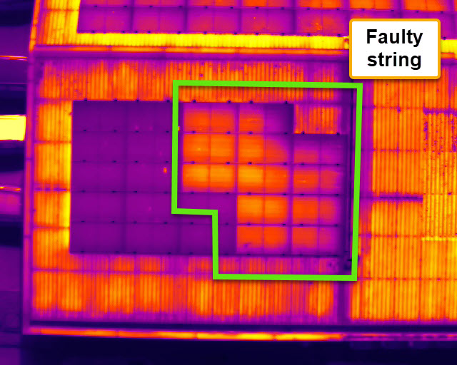
The Morecambe project was a thermal inspection of a roof mounted solar PV array where output suggested something was wrong, but ground level checks had not located the culprit.
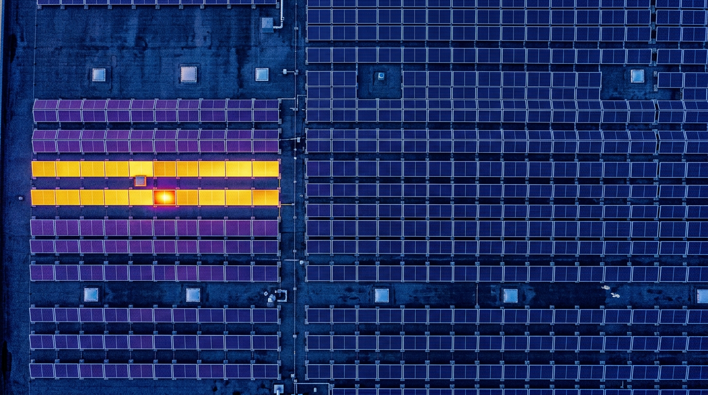
A radiometric thermal camera reads temperature across every module in the array. Electrical faults have recognisable thermal signatures: an entire string running cooler than its neighbours indicates a disconnect, blown fuse or combiner issue; a module with one third of its area running warm is the classic pattern of a failed bypass diode; localised hotspots point to cell or interconnect defects. These faults quietly depress yield. Illustrative industry case studies associate undetected string and module faults with annual output losses in the low single digits per defect, which compounds badly on a large commercial roof.
We carry out this work in line with IEC 62446-3, the international standard for outdoor infrared thermographic inspection of PV systems. That means flying in suitable conditions, clear sky and irradiance of at least 600 W/m2, and delivering classified, geolocated anomalies rather than a folder of pretty pictures, so an O&M contractor can go straight to the affected strings. The weather this week has been near perfect, no cloud dodging required!
Suspect your array is underperforming? Our infrared solar PV inspection service explains what a thermographic survey covers and the report you receive.
The common thread: answers without access
Neither of these jobs required scaffold, MEWP hire or anyone working at height. That is not incidental. Under the Work at Height Regulations 2005, work at height should be avoided where reasonably practicable, and survey and inspection tasks are increasingly the easiest place to design it out.
Access equipment for a traditional roof or structure inspection can run to £800-£3,500 per week; an aerial survey usually removes that line item entirely, and UK providers report overall survey cost reductions of 50-70% against traditional methods.
Conclusion
Two different assets, the same principle: measured data beats assumption, and you should not have to put people at risk to get it. If you have a site, structure or asset that would benefit from accurate aerial data, contact DroneWorks to discuss the most appropriate survey approach.
Ready to Get Started?
If you’re planning earthworks monitoring, a stockpile survey or a solar array inspection and want accurate data without the access costs, get in touch.
We’ll help you understand your options and make sure you get the best value for your budget.
Have questions about drone surveys or any of our services? Let us know what you need - we’re always happy to help.
Remember: A drone survey is an investment in accurate, actionable data that can save you time, money, and headaches down the line. Let’s make your project a success!
If you’re ready to experience the benefits of a drone survey, we’d love to help. Contact us by phone 01772 846229 or post your enquiry via our website.
Let’s discuss how we help you leverage drone technology in your next project.